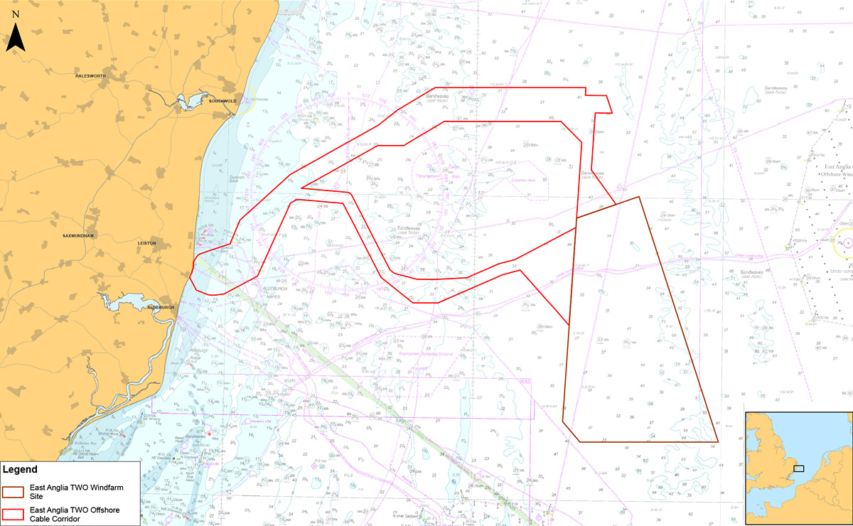
ScottishPower Renewables is investigating the potential for a new offshore windfarm project in the southern North Sea, called East Anglia TWO.
The proposed offshore windfarm site to be developed by East Anglia TWO Ltd, is located in the southern North Sea, approximately 32.56km from its nearest point to the coast at Southwold and 37.02km to the port of Lowestoft. The proposed East Anglia TWO project would have an operational capacity of up to 900MW [1], which is enough to power approximately 800,000 [2] UK households.
East Anglia TWO Application
The Application for East Anglia TWO was submitted to the Planning Inspectorate in October 2019. The Examination closed on 6 July 2021.
In December 2021 the Secretary of State (SoS) for Business, Energy and Industrial Strategy has requested information from ScottishPower Renewables, Suffolk County Council, Natural England, the Marine Management Organisation and all other Interested Parties. The deadline for responses to this second round of consultation and comments on responses to the SoS first round of consultation is 23.59 pm on 31 January 2022.
Therefore, the SoS has set a new deadline for the Decision to be made on this application which is 31 March 2022.
Copies of the Application and accompanying plans, maps and other documentation can still be viewed on The Planning Inspectorate’s website.
The proposed East Anglia TWO Offshore Windfarm has the potential to make a substantial contribution to UK 2030 energy targets by meeting nearly 5% of the UK offshore wind cumulative deployment target for 2030.
The proposed offshore development area comprises of:
- Wind turbines – up to 75 wind turbines would cover an area of 218.4km [2]. The maximum height to the blade tip would be 282m above sea level.
- Offshore platforms – up to four electrical platforms connected by platform link cables to collect the electricity, a construction, operation and maintenance platform and a meteorological mast.
- Subsea cables – inter-array cables connect the turbines to the offshore electrical platform. A maximum of two export cables, buried or protected on the seabed will then transport the electricity to shore. The two cable routing options are the preferred choice in terms of engineering and environmental constraints.

The onshore development area comprises of:
- Landfall location – Horizontal Directional Drilling (HDD) will be required to install the ducts to avoid any construction works on the beach, and a minimum setback distance of 85m from the cliff top will allow for natural coastal erosion based on the potential 100-year erosion prediction and will not compromise the integrity of the cliff.
- Underground cables – up to six single core onshore cables will be buried for a maximum of 9km. For the majority of the route, trenching will be undertaken in which to place the ducts through which the cables are pulled. Manhole covers may be required at some locations to allow for maintenance.
- Public highways – a number of road improvements or modifications will be required to facilitate the ingress and egress from the public highways for construction access or at locations on the existing public road network in order to facilitate construction traffic and/or construction-related deliveries.
- Onshore substation – a maximum building height of 14m and external electrical equipment of up to 14m in height from finished ground level is proposed and the substation will cover an area of 32,300m2 (190x170m).
- National Grid substation – to accommodate the electricity produced by East Anglia TWO (and East Anglia ONE North) an Air Insulated Switchgear (AIS) or Gas Insulated Switchgear (GIS) substation would be required. The maximum height of the AIS would be 6m with a footprint of 145x310m and the maximum height of the GIS would be 16m with a footprint of 120x140m.
- National Grid realignment works – up to one additional pylon within the vicinity of the National Grid substation as well as up to three cable sealing end compounds, up to one cable sealing end (with circuit breaker) compound, and potentially additional strengthening or modification works within the overhead line realignment works area will be required for East Anglia TWO (and East Anglia ONE North).

[1] As measured at point of connection of the onshore cables to the onshore substation [2] Calculated taking the number of megawatts (900) multiplied by the number of hours in one year (8,766), multiplied by the average load factor for offshore wind (33.36%, published by the Digest of United Kingdom Energy Statistics), divided by the average annual household energy consumption (3.781MWh), giving an equivalent of powering 800,416 homes.