The Site
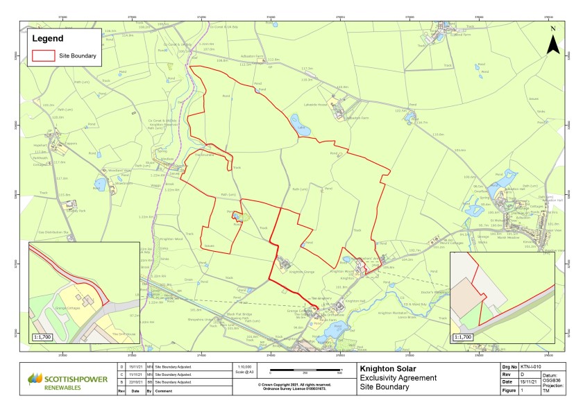
The Site is located approximately 360m north of Knighton, and approximately 800m west of the village of Adbaston, falling within the district of Staffordshire. The Site is approximately 118 hectares (292 acres) in size.

Above: A map showing the Site boundary in red
The land within the Site is currently agricultural and used for arable farming, with hedgerows and mature trees along the field boundaries. The land surrounding the Site comprises agricultural land, with Knighton Reservoir immediately to the west and Shropshire Union Canal to the south. The Site is large enough that the Proposed Development can be accommodated, as well as to allow areas to be set aside for environmental mitigation and biodiversity enhancement purposes.
Site Selection and Design
The following factors fed into the selection of this site:
Solar irradiation levels;
Topography;
Field size and shading;
Suitable access for construction; and
Sited in an area that is free from statutory designations.
The following factors have been taken into consideration and informed the design and layout of the Proposed Development:
Existing Public Rights of Way and thoroughfares;
Existing mature trees and hedgerows;
The location of watercourses and waterbodies;
Existing residential properties;
The location of heritage assets;
Existing underground services including gas mains and private water supplies;
Existing traffic flows and movements during construction; and
Visual effects on local receptors.
These are explored in more detail in the section titled 'Environmental Considerations'.
Go back to the main pageGo to the next page